Course Description
This program is designed to equip students with the knowledge and practical skills required to work as technicians in modern cartographic and GIS establishments. The program focuses on spatial data collection, processing, analysis, and visualization, ensuring that graduates can efficiently handle mapping, surveying, and geospatial analysis tasks.
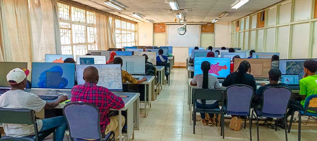
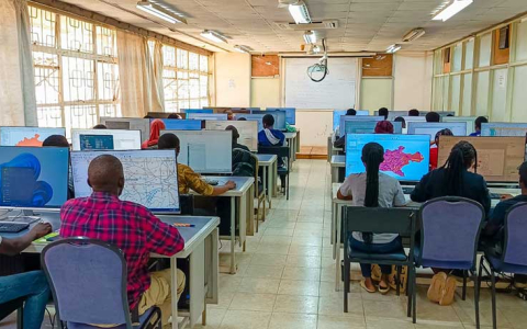
Students will learn to extract and translate mapping data from various sources, including survey reports, satellite imagery, and photogrammetric materials. The course emphasizes competence, efficiency, and cost-effective use of modern cartographic and GIS equipment. It includes extensive hands-on training using industry-standard GIS software such as:
- ArcGIS
- QGIS
- Erdas Imagine
- ArcGIS Online
Course Objectives:
By the end of this program, graduates will be able to:
- Use cartographic equipment efficiently and safely.
- Understand the scope of cartography as applied in surveying and mapping.
- Apply computer-assisted mapping techniques in cartography.
- Communicate professional and administrative matters through appropriate media and channels.
- Conduct and supervise cartographic work performed by instrument operators.
- Utilize GIS for spatial data analysis and visualization.
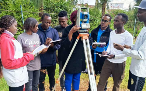
- Conduct precise land measurements using modern surveying instruments.
- Perform GIS projects using various applications, including QGIS, ArcGIS Desktop, and ArcGIS Online.
Entry Requirements
To qualify for admission into the Diploma in Cartography and GIS, candidates must meet any of the following minimum entry requirements:
- KCSE mean grade of C- (Minus) with at least:
- D+ (Plus) in Mathematics
- D+ (Plus) in Geography
Or
- A pass in a Craft Certificate course in Cartography or Land Surveying.
- Equivalent qualifications as recognized by relevant education authorities.
Course Duration
The program runs for 2½ years, divided into:
- 8 terms, which include Internal attachment for practical experience
Course Structure
- Year 1 – Two terms of coursework
- Year 2 – Two terms of coursework + Internal attachment
- Year 3 – Three terms of coursework
Mode of Study
Students can choose from the following study modes:
- Full-time,
- Part-time
- Blended Learning (Online & In-Person)
Career Opportunities
Graduates of the Diploma in Cartography and GIS program can pursue careers in:
- Government Mapping Agencies
- Land Surveying & Geospatial Firms
- Urban and Regional Planning Departments
- Environmental Management Organizations
- Remote Sensing & Satellite Mapping Agencies
- GIS & Cartography Consulting Firms
Why Choose This Program?
- Practical hands-on training in GIS and cartographic techniques.
- Utilization of industry-standard software, including ArcGIS, QGIS, and Erdas Imagine.
- Exposure to modern surveying instruments and geospatial technologies.
- Internship opportunities for real-world experience.
- Strong career prospects in both public and private sectors.
Intakes
The program has three (3) intakes per year:
For additional information, please contact us via email at rcti@rcmrd.org or reach us by phone/WhatsApp at 0101 777 778 or 0114 444 460.